BY JOHN FELDT
BLUE WATER OUTLOOK


SATELLITE


Eye of Hurricane Irma as it passed over Barbuda.

3-D Image of Irma - NASA

Irma Changes Virgin Island Landscape
These NASA satellite images show the widespread browning of the landscape after Irma passed the Virgin Islands. There are a number of possible reasons for this. Lush green tropical vegetation can be ripped away by a storm’s strong winds, leaving the satellite with a view of more bare ground. Also, salt spray whipped up by the hurricane can coat and desiccate leaves while they are still on the trees.


GOES 16 Sees Irma's Second Landfall at Marco Island, Florida
NOAA's GOES-16 captured this image of Hurricane Irma making a second landfall near Marco Island, Florida, in the afternoon of September 10, 2017. After making landfall at Cudjoe Key at 9:10 am EDT, Irma made a second landfall on Marco Island at 3:35 p.m. A wind gust of 130 mph was reported by the Marco Island police, according to the National Weather Service.

Nighttime Image of Irma
NASA-NOAA's Suomi NPP satellite captured night-time look at Hurricane Irma.

Irma Stirs Up Gulf of Mexico
Before

After

International Space Station

Multi-Sensor Rainfall Estimates
The following NOAA rainfall estimates were produced using both rain gauge and radar rainfall observations.

Irma Shows Up On Seismometers
Low-pitched hums associated with Irma have been measured on seismometers. The noise is likely caused by high winds — which cause tiny motions in the ground — and also by trees swaying in the wind, which also transfers energy into the ground.

Stream Gauging
USGS stream gauge measurements

St. Johns River at Main Street in Jacksonville. The river peaked at 5.57 feet, a record, easily beating the old record of 4.1 feet.

Naples, Florida - Water Reversal Into Bay

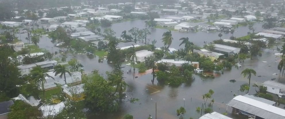
Drones Capture Damage Imagery

Credit: ABC News - Naples Florida


Comments
No comments on this item Please log in to comment by clicking here