LEE COUNTY - March may be going out like a lion instead of a lamb.
Storms moving through the area Friday could present dangerous conditions including high winds, lightning, hail and possible tornadoes.
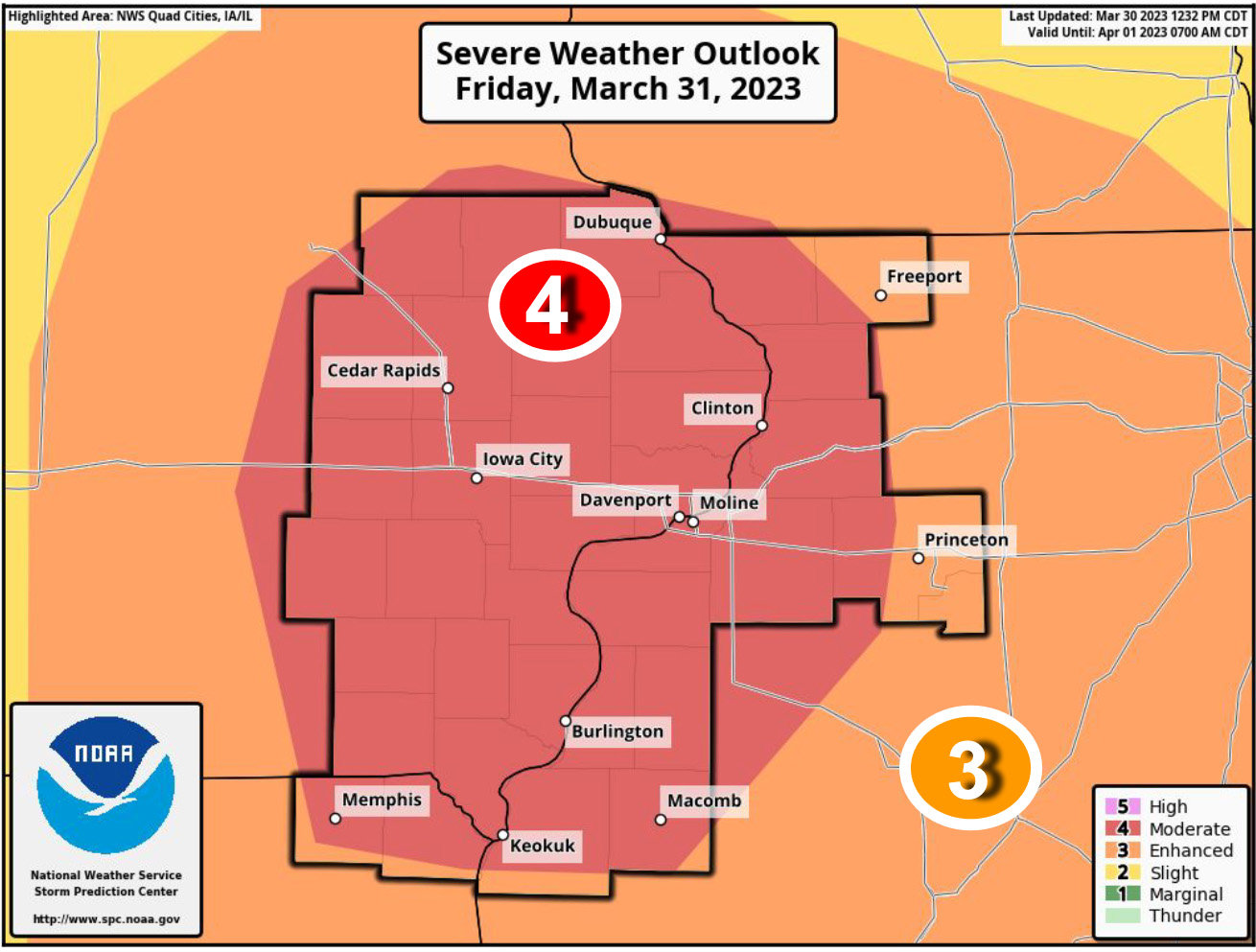
The threat for severe storms has increased for Friday afternoon and early evening, with most of our area now in a Moderate Risk, or level 4 out of 5, of severe storms, according to the National Weather Service's Quad Cities office.
The main hazards will be damaging straight line winds of 70 mph, tornadoes, and large hail. Tornadoes could be strong in nature. The storms are projected to be fast moving from the southwest to the northeast at more than 60 mph.
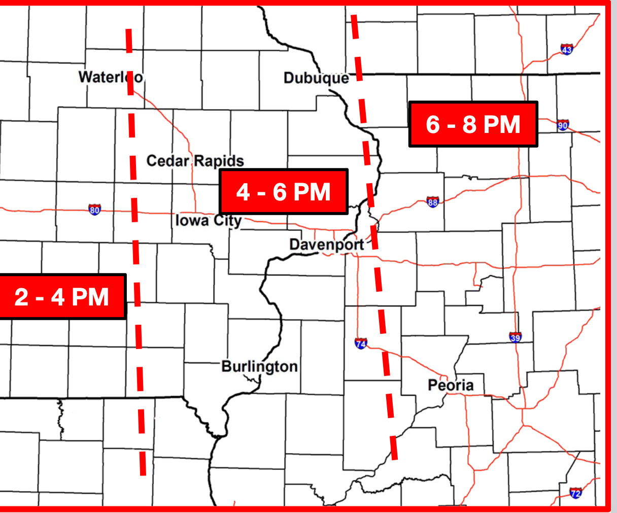
Storms should present between noon and 4 p.m. locally Friday with several rounds of storms possible.
Strong westerly winds are expected after the severe weather threat ends Friday night, with gusts up to 45 mph. These strong gusts should last through Saturday morning.
Temperatures are expected to drop into the 30s and 40s after the storm moves through the area.
Central Lee schools will be dismissing at 1:30 p.m. to ensure the safety of students and staff in the event of severe weather.


Comments
No comments on this item Please log in to comment by clicking here